Tag: Rains

  • MeT forecasts rains in plains, snow over upper reaches till April 20 in J&K

    [ad_1]

    Says Main Activity On April 17,18; Weather System To Affect Transport In Hilly Area, Cause Water-Logging In Low Lying Areas

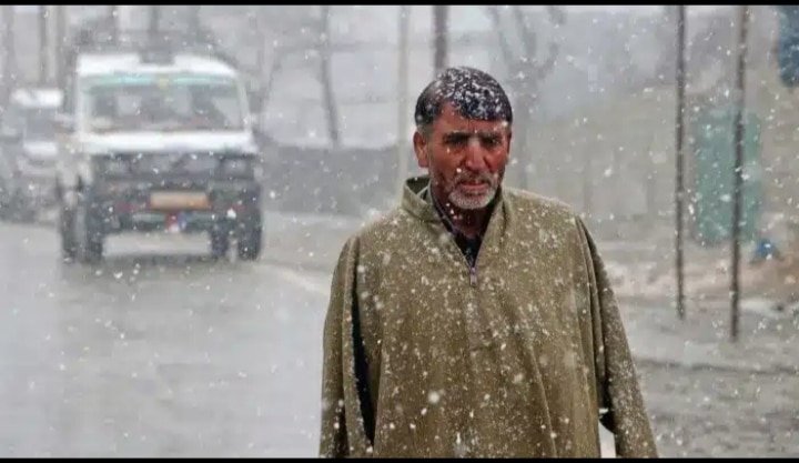
    Srinagar, April 16 (GNS): Weather department has forecast light to moderate rain and snowfall (over higher reaches) from April 17-20 with “main activity” on Monday and Tuesday.

    “During this wet spell, thunderstorms with strong gusty wind reaching (20-30KMPH) and hailstorm is also possible at some places of Jammu and Kashmir,” a meteorological department official here said.

    He said there is possibility of temporary disruption of surface transportation especially over hilly and snowbound areas during April 17-18. Besides, he said, there could be water-logging in low lying areas, damage to orchards as well as “abrupt” fall in day temperature by 7-8°C.

    Regarding temperature, the official told GNS that Srinagar recorded a low of 10.9°C against 9.1°C on the previous night and it was 3.0°C below normal for the summer capital.

    Qazigund, he said, recorded a low of 7.8°C against 6.2°C on the previous night and it was 1.3°C below normal for the gateway town of Kashmir.

    Pahalgam, he said, recorded a low of 5.2°C against 4.6°C on the previous night and it was 3.4°C above normal for the famous tourist resort in south Kashmir’s Anantnag district.

    Kokernag recorded a low of 8.6°C against 10.6°C on the previous night and it was 2.1°C above normal for the place, the officials said.

    Gulmarg recorded a low of 3.8°C against 7.0°C on the previous night and it was 1.5°C above normal for the world famous skiing resort in north Kashmir’s Baramulla district, he said.

    In Kupwara town, he said, the mercury settled at 10.2°C against 5.6°C on the previous night and it was 0.1°C below normal for the north Kashmir area.

    Jammu recorded a low of 26.0°C against 21.2°C on the previous night. It was 6.1°C above normal for J&K’s winter capital, he said.

    Banihal, he said, recorded a low of 9.7°C (above normal by 1.3°C), Batote 14.0°C (above normal by 2.6°C), Katra 19.0°C (1.9°C above normal) and Bhadarwah 9.1°C (1.9°C below normal). Ladakh’s Leh and Kargil recorded a low of 1.6°C and 6.1°C respectively, he said. (GNS)

    [ad_2]
    #MeT #forecasts #rains #plains #snow #upper #reaches #April

    ( With inputs from : thegnskashmir.com )

  • MeT forecasts rains in plains, snow over upper reaches till April 20 in J&K

    MeT forecasts rains in plains, snow over upper reaches till April 20 in J&K

    [ad_1]

    Srinagar, April 16: Weather department has forecast light to moderate rain and snowfall (over higher reaches) from April 17-20 with “main activity” on Monday and Tuesday.

    “During this wet spell, thunderstorms with strong gusty wind reaching (20-30KMPH) and hailstorm is also possible at some places of Jammu and Kashmir,” a meteorological department official here said.

    He said there is possibility of temporary disruption of surface transportation especially over hilly and snowbound areas during April 17-18. Besides, he said, there could be water-logging in low lying areas, damage to orchards as well as “abrupt” fall in day temperature by 7-8°C.

    Regarding temperature, the official told GNS that Srinagar recorded a low of 10.9°C against 9.1°C on the previous night and it was 3.0°C below normal for the summer capital.

    Qazigund, he said, recorded a low of 7.8°C against 6.2°C on the previous night and it was 1.3°C below normal for the gateway town of Kashmir.

    Pahalgam, he said, recorded a low of 5.2°C against 4.6°C on the previous night and it was 3.4°C above normal for the famous tourist resort in south Kashmir’s Anantnag district.

    Kokernag recorded a low of 8.6°C against 10.6°C on the previous night and it was 2.1°C above normal for the place, the officials said.

    Gulmarg recorded a low of 3.8°C against 7.0°C on the previous night and it was 1.5°C above normal for the world famous skiing resort in north Kashmir’s Baramulla district, he said.

    In Kupwara town, he said, the mercury settled at 10.2°C against 5.6°C on the previous night and it was 0.1°C below normal for the north Kashmir area.

    Jammu recorded a low of 26.0°C against 21.2°C on the previous night. It was 6.1°C above normal for J&K’s winter capital, he said.

    Banihal, he said, recorded a low of 9.7°C (above normal by 1.3°C), Batote 14.0°C (above normal by 2.6°C), Katra 19.0°C (1.9°C above normal) and Bhadarwah 9.1°C (1.9°C below normal). Ladakh’s Leh and Kargil recorded a low of 1.6°C and 6.1°C respectively, he said. (GNS)

    [ad_2]
    #MeT #forecasts #rains #plains #snow #upper #reaches #April

    ( With inputs from : roshankashmir.net )

  • Spray Fungicide Before Rains, Follow Spray Schedule: Experts to Orchardists

    [ad_1]

    SRINAGAR: In view of the wet spell forecast from 17th of April, the experts have advised orchardists to spray fungicide before rains to avoid scab-like diseases.

    Quoting experts, KNO reported that it is usually best to apply a fungicide before it rains, because rain causes leaf surfaces to be wet, a requirement for most foliar diseases, and rain may splash spores from leaf to leaf and from plant to plant.

    Therefore, if one is able to coat plants with fungicides prior to a rain, the plant is better protected from disease, they said.

    “Periods of wet weather are when a plant is most vulnerable to foliar disease. Fungicides, properly applied, may help to prevent or slow the initiation of disease and the spread of disease which commonly occurs during or shortly after a rain,” they added.

    Dr Tariq Rasool, a senior scientist at SKUAST (Sher-i-Kashmir University of Agricultural Sciences and Technology) said that as rains are predicted from Sunday, growers must spray fungicide before rains to avoid scab.

    “Orchards where over 50 to 60 percent petals have fallen must be sprayed with any SKUAST recommended fungicide to avoid any disease in future,” he said.

    Those Orchardists who have sprayed in around last week of March and apple flowers are in full, they too can go far fungicides, as research has been found it safe to spray fungicide in bloom without any effect on the fruit, he said.

    He advised farmers that they must use mist spray not full speed spray so that it won’t damage the petals and fruits and mist spray must be used always and the practice of bathing the whole tree must be avoided.

    “Best time for spray is morning and this is the critical stage of the scab so people must avoid mixing more pesticides and insecticides and focus on fungicide only this time,” he said.

    He added that even if it rains, a few hours after spraying fungicide, it will still provide protection to the fruit and keep diseases at bay.

    [ad_2]
    #Spray #Fungicide #Rains #Follow #Spray #Schedule #Experts #Orchardists

    ( With inputs from : kashmirlife.net )

  • Hyderabad: No more rains, twin cities to face hot weather ahead

    Hyderabad: No more rains, twin cities to face hot weather ahead

    [ad_1]

    Hyderabad: The sudden change in weather due to unseasonal rains in the twin cities of Hyderabad and Secunderabad in the last few days has brought great relief to the citizens, but the city is likely to feel the heat of summer next week.

    After the rise in temperature in Hyderabad, the temperature in the city had crossed 40 degrees last week, but due to sudden unseasonal rains, the temperature recorded a drop, due to which the citizens got a lot of relief, but now according to the Meteorological Department, from April 10, the intensity of heat will increase in most districts and twin cities of Telangana from April 10. And this week the weather will be dry.

    Private weather experts predicted that there will be an overall dry spell next week, due to which the city of Hyderabad and other districts will record an increase in temperature. Private meteorologists claimed that overall the weather will be dry, but light rains are likely to be recorded from April 11 onwards and may continue during the current week.

    MS Education Academy

    According to the Telangana State Development Planning Society, night temperatures, too, would soar to 23 degrees Celsius.

    Although some districts including Nizamabad, Nirmal, Adilabad, Kumuram Bheem Asifabad, Jagtial and Mancherial are expected to receive very light to light rains for the next three days, the maximum temperatures would soar across all districts.

    Following the recent rainfall, thunderstorms, and hailstorm, the maximum and minimum temperatures in all districts of Telangana, including Hyderabad, have dipped significantly. The maximum temperatures in Telangana districts decreased from 2.8-5.8 degrees Celsius from the normal temperature.

    [ad_2]
    #Hyderabad #rains #twin #cities #face #hot #weather #ahead

    ( With inputs from www.siasat.com )

  • Hyderabad: Heavy rains along with hail stones surprise city

    Hyderabad: Heavy rains along with hail stones surprise city

    [ad_1]

    Hyderabad: Heavy rains and hailstorms in Hyderabad come as another surprise to city-dwellers this week, after India Meteorological Department – Hyderabad’s (IMD-H) forecast of a yellow alert for Hyderabad. As per the weather forecast, the downpour is here to stay for the weekend.

    Several places in Hyderabad are experiencing heavy rainfalls coupled with strong winds. Some areas are even experiencing light hairstyles.

    Hyderabad City police took to Twitter to share a video of a metro train in the downpour, urging the citizens to drive safely. Several netizens shared videos of hail stones and a heavy downpour on social media saying that the rains come as a much-needed respite from the hot weather the city had been experiencing.

    MS Education Academy

    Despite the forecast of rains, IMD predicts that the maximum temperature in Hyderabad will be in the range of 36 to 40 degrees Celsius.

    The Indian Meteorological Department (IMD) Hyderabad has issued an orange alert for the entire Telangana State till April 7, as more downpours are expected on Thursday and Friday.

    Hyderabad received heavy rains on April 5, leading to power cuts in various parts of the city. Waterlogging was also witnessed at different locations, including the road under PVNR Expressway near Attapur, causing slow traffic flow for some time.

    On Wednesday, as per the Telangana State Development Planning Society (TSDPS), Shaikpet recorded the highest rainfall of 26.5 mm, followed by Asifnagar (19.8 mm), Golkonda (18 mm), Rajendranagar (15.5 mm), Khairtabad (11.3 mm), and Ameerpet (10 mm).

    Many shared videos of heavy rains in the Secundrabad area.

    [ad_2]
    #Hyderabad #Heavy #rains #hail #stones #surprise #city

    ( With inputs from www.siasat.com )

  • More Rains Lash JK, Mercury Stays Below Normal At Most Places

    More Rains Lash JK, Mercury Stays Below Normal At Most Places

    [ad_1]

    SRINAGAR: More rains lashed Jammu and Kashmir since overnight while night temperature stayed below normal at all places except Pahalgam and Bhaderwah on Thursday, officials said.

    Quoting an official from meteorological department,  GNS reported that  in last 24 hours till 0830 hours today, Srinagar received 3.4mm, Qazigund 9.9mm, Pahalgam 4.4mm, Kupwara 9.1mm, Kokernag 9.8mm, Gulmarg 10.8mm, Jammu 0.2mm, Baniha 5.4mm, Batote 2.0mm, Katra 4.0mm and Bhaderwah 1.1mm.

    He said light rain with thunder at few places, mainly towards late afternoon/evening was expected during the next 24 hours.

    From April 7-10, he said, mainly dry weather was expected and generally cloudy weather with light rain at isolated places towards late afternoon/evening has been forecast for April 11. Generally cloudy weather was expected from April 12-15, he said.

    Regarding the temperature, the MeT official said that Srinagar recorded a low of 6.3°C against 2.7°C on the previous night and it was 0.6°C below normal for the summer capital.

    Qazigund, he said, recorded a low of 4.0°C against 3.6°C on the previous night and it was 1.7°C below normal for the gateway town of Kashmir.

    Pahalgam, he said, recorded a low of minus 2.4°C against 1.8°C on the previous night and it was 0.2°C above normal for the famous tourist resort in south Kashmir’s Anantnag district.

    Kokernag recorded a low of 3.1°C against 2.3°C on the previous night and it was 2.3°C below normal for the place, the officials said.

    Gulmarg recorded a low of minus 1.6°C against minus 3.5°C on the previous night and it was 2.1°C below normal for the world famous skiing resort in north Kashmir’s Baramulla district, he said.

    In Kupwara town, he said, the mercury settled at 3.6°C against 1.2°C on the previous night and it was 1.9°C below normal for the north Kashmir area.

    Jammu recorded a low of 14.7°C against 13.1°C on the previous night. It was 3.1°C below normal for J&K’s winter capital, he said.

    Banihal, he said, recorded a low of 5.4°C (below normal by 2.0°C), Batote 6.5°C (below normal by 3.6°C), Katra 11.2°C (3.9°C below normal) and Bhadarwah 6.7°C (0.7°C above normal). Ladakh’s Leh and Kargil recorded a low of minus 2.0°C and 4.0°C respectively, he added.

    [ad_2]
    #Rains #Lash #Mercury #Stays #Normal #Places

    ( With inputs from : kashmirlife.net )

  • Rains Drench JK, More Likely Till April 6

    Rains Drench JK, More Likely Till April 6

    [ad_1]

    SRINAGAR: A spell of light to moderate rain drenched Jammu and Kashmir since last evening even as the weather department predicted intermittent precipitation and thunderstorm to continue at most places of Kashmir and isolated places of Jammu on Tuesday.

    A meteorological department official here said that in the last 24 hours till 0830 hours today, Srinagar received 5.2mm of rain, Qazigund 4.8mm, Pahalgam 6.5mm, Kupwara 19.5mm, Kokernag 5.0mm, Gulmarg 10.8mm, Jammu 29.0mm, Banihal 24.8mm, Batote 18.8mm, Katra 15.0mm, Bhaderwah 11.8mm, and Kathua 9.2 mm.

    Regarding the forecast, he said, intermittent rain and thunderstorm may continue in most places of Kashmir and at isolated places of Jammu.

    On April 5-6, he said, there was the possibility of a brief spell of rain at scattered places of J&K towards late afternoon and evening.

    From April 7-12, he said, mainly dry weather (60-70% chance) was expected in the entire J&K.

    The weather department also urged farmers to avoid spraying orchards till April 6 and maintain proper drainage to drain out excess water in fields.

    Meanwhile, the MeT official said that Srinagar recorded a low of 6.9°C against 7.9°C on the previous night and it was 0.5°C above normal for the summer capital.

    Qazigund, he said, recorded a low of 6.4°C against 5.1°C on the previous night and it was 1.3°C above normal for the gateway town of Kashmir.

    Pahalgam, he said, recorded a low of 3.2°C against 3.0°C on the previous night and it was 1.5°C above normal for the famous tourist resort in south Kashmir’s Anantnag district.

    Kokernag recorded a low of 5.4 °C against 5.2°C on the previous night and it was 0.3°C above normal for the place, the officials said.

    Gulmarg recorded a low of minus 0.5°C against 0.5°C on the previous night and it was 0.3°C above normal for the world-famous skiing resort in north Kashmir’s Baramulla district, he said.

    In Kupwara town, he said, the mercury settled at 4.4°C against 7.2°C on the previous night and it was 0.8°C below normal for the north Kashmir area.

    Jammu recorded a low of 17.1°C against 16.3°C on the previous night. It was 3.9°C below normal for J&K’s winter capital, he said.

    Banihal, he said, recorded a low of 6.5°C (below normal by 0.5°C), Batote 7.3°C (below normal by 1.6°C), Katra 11.5°C (3.0°C below normal), and Bhadarwah 6.2°C (0.6°C below normal). Ladakh’s Leh recorded a low of minus 2.5°C, he added. (GNS)

    [ad_2]
    #Rains #Drench #April

    ( With inputs from : kashmirlife.net )

  • Rains Drench J&K; More Likely Till April 6

    [ad_1]

    Srinagar, April 4: A spell of light to moderate rain drenched Jammu and Kashmir since last evening even as the weather department predicted intermittent precipitation and thunderstorm to continue at most places of Kashmir and at isolated places of Jammu on Tuesday.

    A meteorological department official here told GNS that in last 24 hours till 0830 hours today, Srinagar received 5.2mm of rain, Qazigund 4.8mm, Pahalgam 6.5mm, Kupwara 19.5mm, Kokernag 5.0mm, Gulmarg 10.8mm, Jammu 29.0mm, Baniha 24.8mm, Batote 18.8mm, Katra 15.0mm, Bhaderwah 11.8mm and Kathua 9.2 mm.

    Regarding the forecast, he said, intermittent rain and thunderstorm may continue at most places of Kashmir and at isolated places of Jammu.

    On April 5-6, he said, there was possibility of a brief spell of rain at scattered places of J&K towards late afternoon and evening.

    From April 7-12, he said, mainly dry weather (60-70% chance) was expected in the entire J&K.

    The weather department also urged farmers to avoid spraying orchards till April 6 and maintain proper drainage to drain out excess water in fields.

    Meanwhile, the MeT official said that Srinagar recorded a low of 6.9°C against 7.9°C on the previous night and it was 0.5°C above normal for the summer capital.

    Qazigund, he said, recorded a low of 6.4°C against 5.1°C on the previous night and it was 1.3°C above normal for the gateway town of Kashmir.

    Pahalgam, he said, recorded a low of 3.2°C against 3.0°C on the previous night and it was 1.5°C above normal for the famous tourist resort in south Kashmir’s Anantnag district.

    Kokernag recorded a low of 5.4 °C against 5.2°C on the previous night and it was 0.3°C above normal for the place, the officials said.

    Gulmarg recorded a low of minus 0.5°C against 0.5°C on the previous night and it was 0.3°C above normal for the world famous skiing resort in north Kashmir’s Baramulla district, he said.

    In Kupwara town, he said, the mercury settled at 4.4°C against 7.2°C on the previous night and it was 0.8°C below normal for the north Kashmir area.

    Jammu recorded a low of 17.1°C against 16.3°C on the previous night. It was 3.9°C below normal for J&K’s winter capital, he said.

    Banihal, he said, recorded a low of 6.5°C (below normal by 0.5°C), Batote 7.3°C (below normal by 1.6°C), Katra 11.5°C (3.0°C below normal) and Bhadarwah 6.2°C (0.6°C below normal). Ladakh’s Leh recorded a low of minus 2.5°C, he added. (GNS)

    [ad_2]
    #Rains #Drench #April

    ( With inputs from : roshankashmir.net )

  • 15 Goats Die As Cowshed Collapses Amid Rains 

    [ad_1]

    SRINAGAR: 15 goats died after a cattle shed collapsed allegedly due to heavy rains in Dhokri area of Poonch on Monday.

    Official sources told GNS that late last night, at about 0230 hours, the cattle shed of one Khadam Hussain son of Mohammad Hussain collapsed in Panchayat Dhokri in Poonch, resulting in the death of 15 goats.

    They said that police have registered a case and started further investigations. (GNS)

    [ad_2]
    #Goats #Die #Cowshed #Collapses #Rains

    ( With inputs from : kashmirlife.net )

  • MeT forecasts ‘fairly widespread’ rains in J&K – Kashmir News

    [ad_1]

    IMG 20230403 120955

    Srinagar, April 03:  Weather department here forecast fairly widespread light to moderate rain and thunderstorm over Jammu and Kashmir during next 24 hours.

    A meteorological department official here told fairly widespread to scattered light rain and thunderstorm was expected during the subsequent two days in J&K.

    Regarding rainfall during the last 24 hours till 0830 hours today, the MeT official said, Srinagar received 0.3mm, Qazigund 00mm, Pahalgam traces, Kupwara 2.0mm, Kokernag traces Gulmarg 1.2mm and Jammu 0.2mm.

    Regarding temperature, the MeT official said that Srinagar recorded a low of 7.9°C against 6.7°C on the previous night and it was 1.5°C above normal for the summer capital.

    Qazigund, he said, recorded a low of 5.1°C against 3.5°C on the previous night and it was 0.7°C above normal for the gateway town of Kashmir.

    Pahalgam, he said, recorded a low of 3.0°C against 2.7°C on the previous night and it was 1.3°C above normal for the famous tourist resort in south Kashmir’s Anantnag district.

    Kokernag recorded a low of 5.2°C against 3.1°C on the previous night and it was 0.1°C above normal for the place, the officials said.

    Gulmarg recorded a low of 0.5°C against minus 0.6°C on the previous night and it was 0.1°C above normal for the world famous skiing resort in north Kashmir’s Baramulla district, he said.

    In Kupwara town, he said, the mercury settled at 7.2°C against 6.6°C on the previous night and it was 2.0°C above normal for the north Kashmir area.

    Jammu recorded a low of 16.3°C against 12.3°C on the previous night. It was 0.8°C below normal for J&K’s winter capital, he said.

    Banihal, he said, recorded a low of 7.5°C (above normal by 0.5°C), Batote 9.0°C (above normal by 0.1°C), Katra 14.0°C (0.5°C below normal) and Bhadarwah 6.3°C (0.7°C below normal). Ladakh’s Leh and Kargil recorded a low of minus 2.5°C and 3.6°C respectively. (GNS)

    The post MeT forecasts ‘fairly widespread’ rains in J&K appeared first on Kashmir News.

    [ad_2]
    #MeT #forecasts #widespread #rains #Kashmir #News

    ( With inputs from : kashmirnews.in )